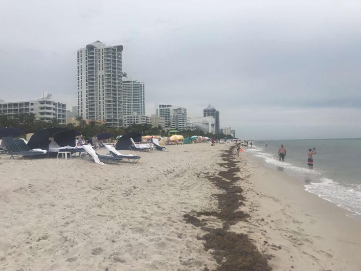
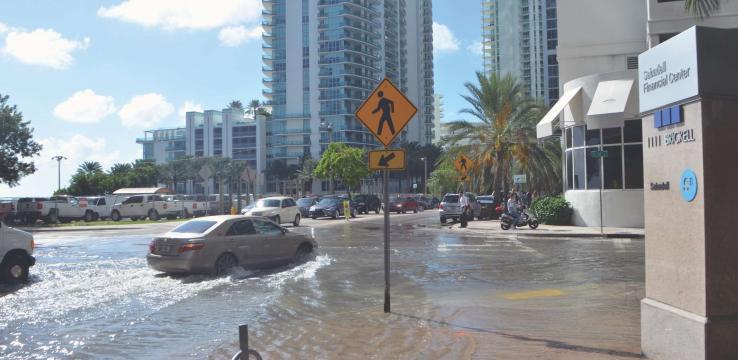
Perhaps more than any other city in America, Miami arouses our collective fear and imagination about climate change and the future. At the heart of this curiosity is a hypothesis — stoked by the media — that Miami is doomed to a watery fate, that it has no viable future and that it should begin retreating from sea level rise and other coastal hazards. Many widely read stories have been built on this narrative: in Rolling Stone, the New York Times, the Guardian U.K. – and even in Rep. Alexandria Ocasio-Cortez’s recent promotional video for the Green New Deal. Underlying this, of course, is the undeniable reality of irreversible and accelerating sea level rise, a brutal record of damaging major hurricanes1 and the experience of more frequent sunny-day or “nuisance” flooding and rain bomb 2 events occurring in the region.
But these stories also paint a picture of self-inflicted and increasing vulnerability. Real estate development proceeds at a breakneck pace, much of it adjacent to a long and unprotected coastline (save for some privately built bulkheads and seawalls) and atop a porous limestone rock foundation that will fail to stop rising water. Florida is not known for a holistic, nature-based approach to coastal management — or for taking action on climate change at all. Rather than crafting statewide plans for both managed retreat and
coastal protection, like nearby Louisiana is doing, the state can appear cavalier about the threats it faces as it welcomes global investment and real estate wealth. Other coastal cities and city-dwellers may read about it from afar, alternately with empathy, envy and maybe a little schadenfreude.
SPUR visited Miami this year to observe how closely the city’s approach to resilience hews to the dire narratives we’ve heard about. The SPUR contingent visited raised streets and marinas in Miami Beach, saw elevated coastal parks and wastewater treatment plants, learned about Miami’s plans to focus on transit-oriented development as a resilience strategy, toured a research institute that is testing coastal defenses and building designs in simulated hurricane conditions, walked around a living shoreline restoration project, and met with two of the region’s chief resilience officers and their teams.
We learned that the local story is much more hopeful and optimistic than we’d believed. We saw that Miami is not giving up despite the major threats it faces. We learned that the city believes that it has a future to protect and is invested in doing so. We also brought back some ideas the Bay Area might consider. Though we are less threatened by major hurricanes, our region is quite vulnerable to the same long-term trends, and much of our urban infrastructure and development is in floodable coastal areas, too. Ideas and actions that seem especially relevant to the Bay Area include the following:
Creating shared regional agreements on climate change. Ten years ago, four counties and several major partner cities formed the Southeast Florida Climate Compact to collaborate and share technical information on climate change mitigation and adaptation. The Compact emerged from a desire at the local level to take action, in a state well known for actively avoiding climate leadership. But it has become much more than a meeting point for county planning staff and resilience officials to share resources and discuss mutual concerns. Through the compact, the counties and their city partners have adopted a set of unified sea level rise projections to aid in resilience planning. They hold a regional summit each year to share knowledge and discuss climate agendas with a broad swath of public and private stakeholders. In 2012, they developed a Regional Climate Action Plan to advance climate mitigation activities across sectors — energy, agriculture, water supply and more — and plan to update it every five years.
Perhaps most intriguingly for the Bay Area to watch and potentially to copy, the parties to the compact annually develop and advocate for a shared bipartisan legislative platform. Every year, the counties together develop and adopt a set of state and federal legislative principles and priorities. In 2019, for example, state-level priorities include supporting green and resilient building code amendments, increasing funding for Everglades restoration, supporting the integration of climate adaptation into pre-disaster mitigation plans and projects, and opposing oil drilling and exploration within Florida or off its shores. Federal policy priorities include opposing efforts to weaken emission standards for power plants, supporting efforts to include resilience funding in federal agency budgets, supporting a national price on carbon, and supporting efforts to reauthorize and strengthen the National Flood Insurance Program. A major legislative success so far is establishing in Florida law and general plans the concept of “Adaptation Action Areas” — a way to identify areas vulnerable to sea level rise in planning documents and to prioritize them for infrastructure investments and other funding.
Parlaying collective investments into visible improvements that engage people in thinking about the future. Our tour of Sunset Harbour, one of the lowest-lying areas on the west side of the barrier island that is Miami Beach, featured highly visible flood control and stormwater management investments. The sidewalks and streets we walked on were several feet higher than surrounding gardens, restaurant patios and building entrances. This neighborhood is one of the earliest test sites for the infrastructural changes that will be necessary across the cities of Miami and Miami Beach if they want to keep up with sea level rise. Since establishing a fixed elevation relative to the tides all through the city of Miami Beach, and actually building streets up to them in Sunset Harbour, this neighborhood has seen no instances of sunny day flooding – a major success. The visible street changes and elevation increases have helped people to realize that change is coming and that, despite the nuisances and challenges of accessibility during construction, in the end, these efforts make the place livable. The city funded all of these improvements without state or federal resources, instead using voter-approved bond funding and revenue from stormwater fees. This showed people a future that their collective investments could make. The city has estimated that 60% of its roads still need to be elevated to the new level at which Sunset Harbour now sits.
Soliciting technical advice and managing risk adaptively. The Miami region has been proactive about soliciting advice from external sources and parlaying it into policy change and preparedness. Similar to how the Bay Area was part of the Rockefeller 100 Resilient Cities program (Berkeley, Oakland and San Francisco all participated in the program), the southeast Florida 100RC effort included Miami-Dade County and the cities of Miami and Miami Beach. This effort supported an agreement to develop Resilient 305, a 20-year regional resilience strategy that was published this year. In 2018, the City of Miami Beach also engaged the Urban Land Institute (ULI) to review and workshop the city’s 10-year stormwater manage-ment and capital improvement program and to make recommendations. ULI found that the city had been very proactive about updating its new required street elevations, raising local funding to support its efforts, engaging the public in the planning process and collaborating with the city and region. ULI recommended a number of actions that the city is implementing already, including improved modeling of flood risks, using more green infrastructure and integrating resilience into local cultural identity. For example, in response to several rain-bomb events in 2017 that delivered 7 inches of rain in an hour (an amount the city’s stormwater pumps would typically handle in a 24-hour period), Miami Beach is not only adding 70 new pumps but is also working with residents to design the pumps to be more visually attractive. The city moves fast to implement measures and ideas that have been identified as having near-term resilience benefits.

Communicating that adaptation for long-term change is necessary — and a shared responsibility. With recent major hurricanes, including Hurricane Irma in 2017 and Hurricane Michael in 2018, still lingering in the public’s consciousness, there is little doubt that many Miami residents are aware of their vulnerability to climate change’s most dramatic impacts. However, the issue of slower-moving sea level rise may be less well known — and perhaps less worrying. Some coastal properties along Miami’s protected Biscayne Bay are uninsurable, for example, yet remain highly desirable real estate. As a result, local government must continuously communicate with and educate the public about the need for taking immediate action to prepare for sea level rise. Miami Beach has developed a website and app, Miami Beach Rising Above, that shares climate change information and property-specific flood risks and also allows visitors to take narrated virtual tours, including one of the raised streets and infrastructural improvements in low-lying Sunset Harbour and a kayak tour exploring the ecological history of Biscayne Bay, with more to come. The app specifically shares how the city’s past experience of shaping the landscape can be used to adapt the urban environment for climate change. The city also uses these tools to show residents how their collective infrastructural improvements have improved citywide flood ratings under the National Flood Insurance Program, producing savings on insurance premiums. Finally, the city is working at the site scale by providing technical assistance to help property owners adjust to the new elevated streets. While stormwater fees collected from all residents pay for public realm improvements, pumps, elevated streets and other public works, property owners are responsible for “harmonizing” buildings to new street elevations. Recognizing that this is not just a public engagement challenge but necessary to scale up in the near term, the city is working with a coalition of 14 historic districts to help them develop templates and a scalable design approach to get old buildings to meet raised streets — and to protect the city’s cultural and architectural resources into the future.
Having faith that the work will continue. People working in government in Miami-Dade and Miami Beach understand that the future doesn’t end with them. For example, when asked how she thinks about the stark realities of 2 to 6 feet of sea level rise in the region by 2060, Chief Resilience Officer for Miami Beach Susy Torriente responded that although the challenges are real, she doesn’t “let them paralyze me or stop me from taking action today.” In a world with one-year budgets, four-year strategic plans and election cycles signaling changing political priorities, a reality-based approach to a long-term threat requires doing the best one can at the time with available evidence and resources.
The project of building resilience is going to be slow and continuous, extending beyond all of our lifetimes. Elevating all of Miami Beach’s streets to 3.7 feet above sea level might be possible within 20 to 25 years, but securing a truly resilient future for Miami will never happen. Rather, resilience is a process, one that will be essential to city governance, planning and safety from here on out.
In Miami, we can see what climate change means for cities, and what the threat demands. We need to work regionally. To obtain actionable science and act on it. To raise local funding and show the public what they paid for. To understand that the work will continue as the set of hazards changes or worsens. Here, as there, we need to work together.
Endnotes
1 In the last few decades, Category 4 and 5 hurricanes that made landfall in Florida include Hurricane Andrew (1992), Hurricane Charley (2004), Hurricane Irma (2017) and Hurricane Michael (2018).
2 Sunny-day or nuisance flooding describes the temporary inundation of low-lying areas, especially streets, during exceptionally high tide events, such as at full and new moons. A rain bomb, or microburst, is an intense small-scale downdraft produced by a thunderstorm or rain shower.

