As the end users of design, we are often limited to the prescribed use of a space. Yet, to be everyday urbanists means to liberate ourselves from that prescriptive logic and find the uses we need in the spaces we have at hand. In the same way that little kids find forts in trundle beds, we must enact what we desire from a city in the city we have.
Accordingly, I set out to find Frederick Law Olmsted’s “Emerald Necklace” — a network of parks that seamlessly spans Boston — in San Francisco by tracing a path from Bernal Heights to the Presidio through city parks and community gardens.
Employing Google maps and the companionship of friends, I tracked a 9.7-mile routefrom Holly Park to Baker Beach with no more than three blocks between all green spaces. On an unusually sunny Saturday afternoon, we headed out to conquer the coyote canyons of Glen Park, the quietude of Mount Sutro and the musty beaches of the Presidio. With our group ranging from four to 16 people at various stages of the hike, we summitted and careened down various peaks in San Francisco, proving the true walkability of our city.
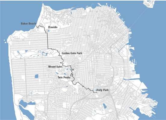
Map. Trekking through four of San Francisco's largest parks, as well as tiny community gardens and block-wide greentops like Holly Park, the route took us from an altitude of 922 feet at the top of Twin Peaks down to sea level in the sandy Presidio.
![]()
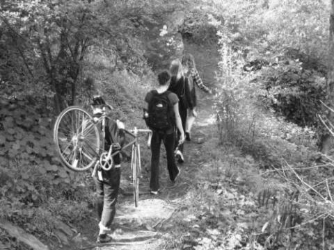
Holly Park. The hike began in the sunny neighborhood of Bernal Heights. We circled Holly Park looking for late arrivers before heading up toward Glen Park Canyon, passing playgrounds, community gardens and Billy Goat Hill along the way. Photo by Cali Pfaff.
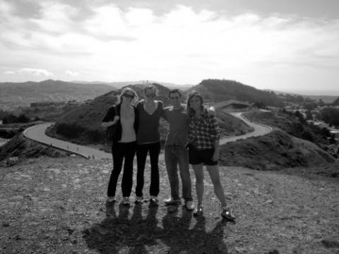
Twin Peaks. Midday we topped the second summit of Twin Peaks after needling through the backyards of Diamonds Heights. With minimal clouds in sight, we could see the round cap of Bernal, from where we came, all the way to the famous trusses of Golden Gate Bridge. Photo by Cali Pfaff.
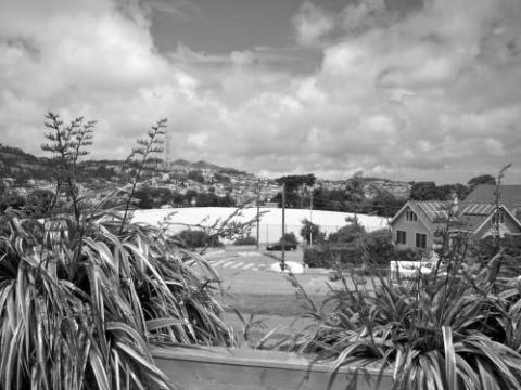
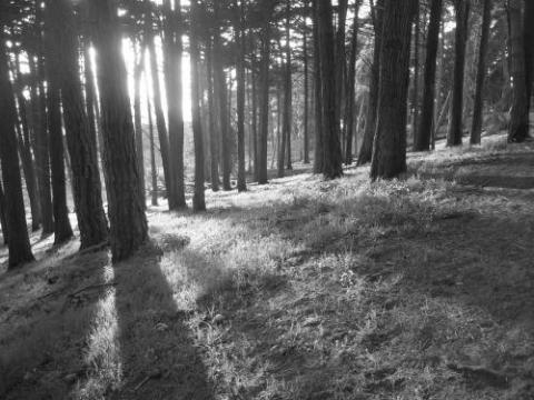
Mount Sutro. We headed down into the Mount Sutro Open Space Reserve, where the only sounds were our own laughter and the wind between leaves on trees. In its quietude the place was pointedly un-urban, and for that moment we were its sole human inhabitants. Photo by Jake Moore.
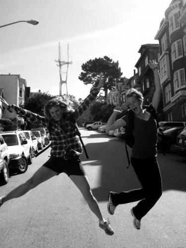
Sutro Tower. Content to have no more uphills, we jumped for joy in the shadow of
the Sutro Tower. We snaked down a landscaped stairwell, complete with an abandoned Fisher Price swing set, in our descent to Golden Gate Park. Photo by Jake Moore.
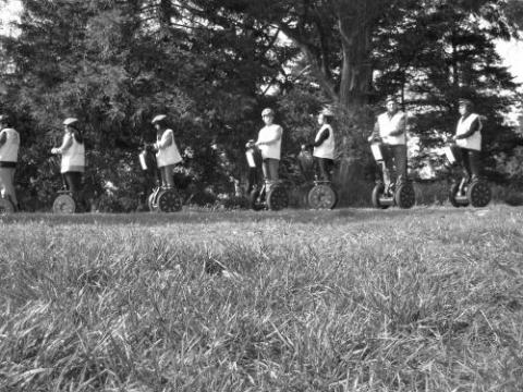
Golden Gate Park. Equipped with orange juice, beer and bread, we met some of
our lazier counterparts for drinks on the top of Golden Gate’s Hippie Hill. While we
lounged in the sun, a gloriously dorky group of tourists on Segways paused behind us. Photo by Cali Pfaff.
Presidio. As the day wore on, we followed the rail-thin stretches of parkland lining Park Presidio Boulevard toward the Pacific Ocean. Whittled down from a group of 16 back to four, we navigated cypress groves and the perfect light between them. Photo by Cali Pfaff.
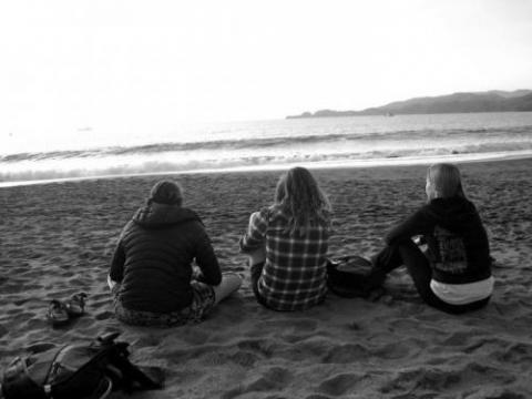
Baker Beach. Four hours and almost ten miles later, we settled into the
sands of Baker Beach for one well-deserved sunset before catching a crosscity
cab home. The cost of our labors? $23.60. Photo by Jake Moore.