What is the Ocean Beach Master Plan?
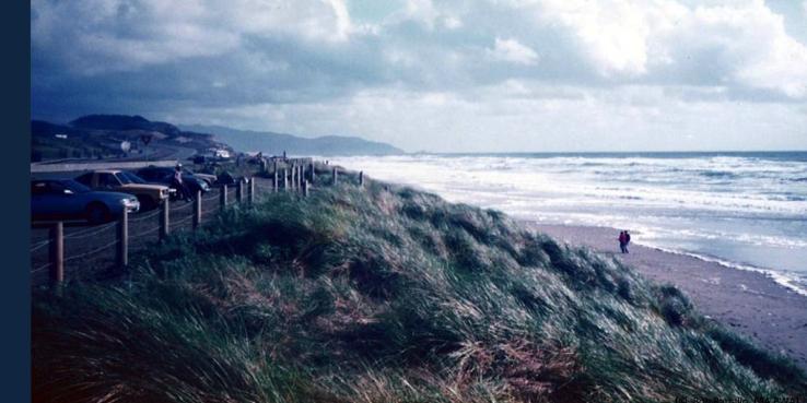
The Ocean Beach Master Plan is a long-term vision for Ocean Beach that addresses public access, infrastructure protection, and ecological function in the context of severe coastal erosion and anticipated sea level rise.
Has there been any public outreach?
The Plan was developed through a major public and interagency process, involving (to date) five major public workshops and numerous community and stakeholder meetings along with exhibitions, forums, and online surveys. It was led by SPUR, and emerged from more than a decade of work by two community-led task forces, the Ocean Beach Task Force and the Ocean Beach Vision Council.
What is being proposed for the Great Highway?
In the Ocean Beach Master Plan, SPUR recommends gradually (over a decade or more) narrowing and eventually closing the Great Highway between Sloat and Skyline, and rerouting North-South auto traffic behind the Zoo via Sloat and Skyline. Streets and intersections along this route would be upgraded to improve their traffic capacity, improve conditions for all road users and prevent major congestion impacts. New coastal access parking would be provided in a safe location near Skyline Boulevard. South of Sloat, a new trail would link Ocean Beach to the Zoo, Fort Funston, and Lake Merced.
Why does the plan propose the eventual closure of part of the Great Highway?
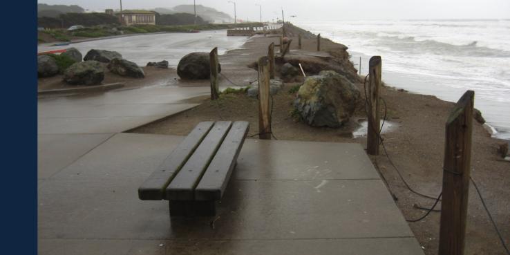
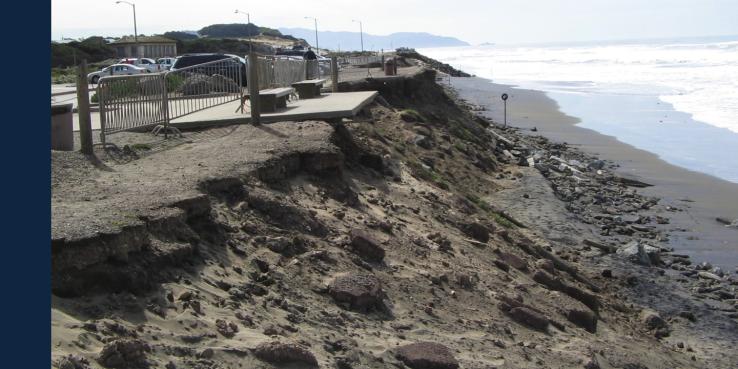
This stretch of roadway is exposed to chronic and worsening coastal erosion and will be increasingly difficult to keep open. In 2010, winter storms resulted in the partial closure of this portion of the road for ten months. Bluffs receded forty feet in some locations, threatening not just the road, but wastewater infrastructure as well. Sea-level rise and increased winter storms are projected to worsen these conditions in the coming decades. Inland circulation routes would be safer from coastal hazards.
The space made available by this closure would be used for coastal protection measures, public recreational access, and environmental restoration.
Can't you just protect the road with a hard structure?
In theory, yes. A large seawall or boulder revetment could keep erosion at bay for some time. However, Ocean Beach is a National Park, and connects several important open space and habitat areas. Widespread coastal armoring would likely result in significant beach loss, degrading public access and habitat. The National Park Service and the California Coastal Commission, who issue the permits required for coastal protection measures at Ocean Beach, are unlikely to approve such measures.
In 2011, the California Coastal Commission unanimously rejected a permit application from the City and County of San Francisco for additional coastal armoring. Local advocates, including Surfrider, Golden Gate Audubon, Save the Waves, and others, have also strongly opposed this kind of coastal armoring and instead favor an approach that includes "managed retreat". The Ocean Beach Master Plan proposes a combination of hard structures, managed retreat, and "beach nourishment" (sand placement).
Won't this cause terrible traffic?
No. The roadways near Ocean Beach have lots of unused capacity, but some road segments and many intersections are poorly designed and not performing well. The designs in the SPUR proposal would improve those intersections and roadways, allowing us to squeeze more capacity from existing roads. But to make sure this is true, we are developing a detailed traffic analysis.
Of course, occasional big events and and warm weather already result in frustrating congestion and that would inevitably continue. SPUR is engaged in a careful study of the traffic and circulation impacts of these proposals, working with licensed traffic engineers and city agencies to study the results using the city's 40-year forecasting model. This work will be made available to the public and to city agencies for later use in an environmental review process.
What does the plan propose North of Sloat?
The Ocean Beach Master Plan includes a proposal to narrow the Great Highway North of Sloat ("Key Move 3"). However, because of community concerns, SPUR is no longer actively pursuing that recommendation. We are working on designs to improve the connection between Golden Gate Park and Ocean Beach, while preserving beach parking and event capacity in that area.
Who funded the Ocean Beach Master Plan?
The OBMP and subsequent studies are funded by the California State Coastal Conservancy, the San Francisco Public Utilities Commission, and the National Park Service.
Why is SPUR involved in this process?
A basic challenge at Ocean Beach is the many overlapping jurisdictions of different public agencies, each of which has different responsibilities and priorities. These include the National Park Service, the SF Public Utilities Commission, the CA Coastal Commission, The SF Department of Public Works, the US Army Corps of Engineers, and the SF Dept of Recreation and Parks, among many others. In addition, many advocates and community stakeholders are involved. SPUR, a nonprofit research and advocacy organization, was asked by the Ocean Beach Vision Council to serve a "convening" role, to bring these many voices and perspectives to the table to take a long-term view.
When might these changes take place?
These proposals are intended to be implemented gradually, over a decade or more. Because this is an "adaptive" approach, the timing is driven in part by how -- and how quickly -- erosion occurs. Some actions will respond to "triggers" defined by coastal engineers to ensure safety, others by more conventional processes like funding and permitting.
The earliest change likely to occur (probably in 2-3 years) is the narrowing of the Great Highway south of Sloat Boulevard from three lanes to two. As part of repair and restoration from the 2010 storms, the SF Department of Public Works has funds from Caltrans and the Federal Highway Administration to complete this work. SPUR is working closely with the city to ensure that this project is coordinated with the long-term vision.
What is the process for a decision on these proposals?
To be implemented, the proposals in the Ocean Beach Master Plan need to be subjected to environmental review under the California Environmental Quality Act (CEQA) which would require additional technical analysis, consideration of project alternatives, and public outreach. San Francisco is also initiating a process to update it's "Local Coastal Program" or LCP, a Coastal Commission-approved elemen of the city's General Plan that covers the Coastal Zone (as defined in the Coastal Act).
Is there a deadline for public comment about these proposals?
No! Your thoughts are always welcome, and are always gathered and published as part of the project's record. We occasionally establish deadlines for comments on specific issues or meetings, so that we can gather and publish related comments together.
How can I learn more about the Ocean Beach Master Plan?
Visit our project website www.spur.org/oceanbeach There you will find the Plan document, along with related news and information, materials from our public workshops, and public feedback. You can also sign up for our mailing list to be notified of future meetings and news.
You can email the project team at [email protected]


