What are unaccepted streets and paper streets, and how can they help make San Francisco a greener place?
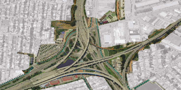
SPUR’s 2011 Piero N. Patri Fellow, Sarah Moos, spent this summer studying the city's unmaintained and underused rights-of-way. The resulting project, Unaccepted Streets: From Paper to Reality, proposes to transform some of the city's overlooked areas into a publicly accesible network that would link communities to open spaces such as the Blue Greenway, as well as to each other.
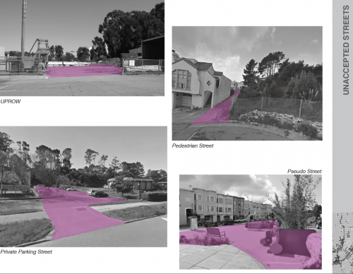
An “unaccepted street” is any public right-of-way not accepted by the city for maintenance. A “paper street” is an unimproved street that is demarcated on maps and legislated as a public right-of-way but that may not actually exist on the ground. Below are four examples: an uprow, or unimproved utility right-of-way; a pedestrian street, designated for pedestrian-only use; a private parking street, a street being used for parking and under private jurisdiction for maintenance; and Guerrero Park, a Pavement to Parks project.
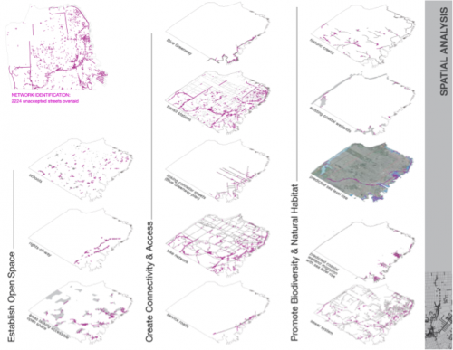
With the aid of Geographic Information Systems (GIS), Moos, a master's candidate in UC Berkeley’s Landscape Architecture and City and Regional Planning program, surveyed 2,224 unaccepted streets and 323 paper streets in San Francisco. She filtered the data through spatial overlays to identify the areas within the city that provide the best opportunity for transforming these not-quite-real streets into useful public spaces.
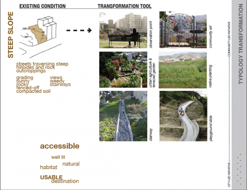
After investigating the existing conditions of the streets in real life, Moos identified ten typologies of unaccepted streets. She then developed a toolkit of interventions such as stairs, benches and plantings that could be applied to transform these sites, improving their condition, accessibility and connection to a larger network of linked public rights-of-way.
Moos singled out nine areas of targeted study in San Francisco’s southeastern neighborhoods. She then met with neighborhood groups, city officials and others to determine which design interventions might work best for these sites.
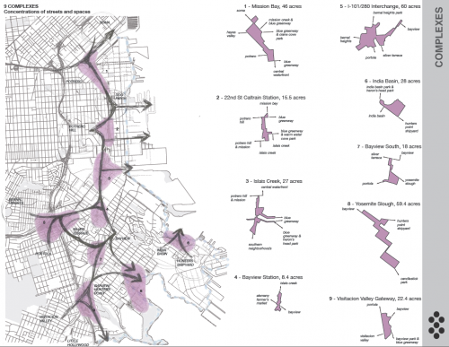
Her research is the first step toward connecting these rights-of-way to improve neighborhood access to green space and connect southeastern San Francisco to a broader open-space network.
Learn more about the Piero N. Patri Fellowship >>
Stop by the Urban Center to pick up a hard copy of the final project map or download it below.