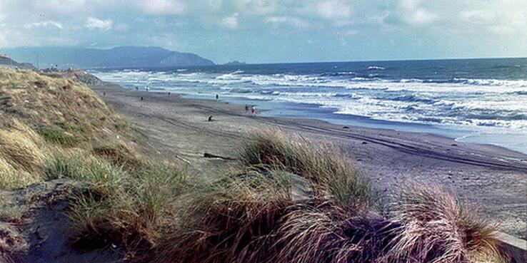
The Ocean Beach master planning process took a big step forward this month. The project team, led by SPUR, presented four “test scenarios” at its second public meeting on June 4. Based on input from our first public meeting in January, the scenarios explore the outcomes of very different approaches to managing coastal erosion, infrastructure and ecology at Ocean Beach until the year 2100. None was presented as a final answer; instead these test scenarios are extreme cases, intended to inform the conversation by mapping out the widest possible range of options. Here’s what they look at:
Test Scenario A: Maximum Habitat
This scenario prioritizes ecological restoration and accommodating natural processes through “managed retreat,” or allowing the shoreline to advance inland. It is the only scenario in which the project boundary moves inland, requiring major infrastructure reconstruction and the gradual acquisition of private property to allow for a wide beach and native dune field.
Test Scenario B: Maximum Recreation
This scenario prioritizes recreational use and visitor amenities, while maintaining the existing character of the beach to the extent possible. It relies on “beach nourishment” (i.e., replacing sand) and an artificial reef for coastal protection, and features selective replanting of dunes and an active urban beachfront with attractions and amenities along the promenade north of Lincoln Way.
Test Scenario C: Maximum Green Infrastructure
This scenario prioritizes investment in storm-water management to create a more resilient and sustainable infrastructure system. Through sustained investment in permeable pavement, green streets, rain gardens, swales and creek restoration, storm water is removed from the combined sewer/storm-water system, decreasing the likelihood of combined discharges in the face of climate-related changes in rainfall. Lake Merced is restored as a centerpiece of the local hydrology, with an outlet to the ocean. The Lake Merced Wastewater Tunnel (a stormwater overflow container) is relocated and may need less storage capacity. With less emphasis on coastal management, the width of the beach is reduced.
Test Scenario D: Maximum Infrastructure
This scenario prioritizes the function and integrity of existing infrastructure services and investments. Incremental armoring on an emergency basis continues, supplemented by beach nourishment and more permanent armoring in the form of seawalls and, south of Sloat Boulevard, an offshore breakwater. The Westside Transport Box (a stormwater overflow container) is reinforced and raised as the shore recedes, and portions of the beach are replaced by a promenade atop a seawall.
After the scenarios were presented, participants then rolled up their sleeves to mix and match elements from the different test scenarios and propose what they felt was a best-case approach. A range of opinions emerged, and nearly everyone found things to object to and to be enthusiastic about. The group’s ideas will provide input to the project team as we move forward to create a draft approach, which will be presented at the third workshop in October.
View the public workshop presentation >>
The project team used animated rendering to illustrate two of the area’s daunting challenges: the coastal sediment system that shapes the beach and the vulnerable sewer infrastructure complex that protects water quality in the ocean:
View the sediment animation >>
View the wastewater animation >>